Measuring altitudes based on changes in atmospheric pressure
The altimeter determines the altitude at your current location based on accumulated atmospheric pressure changes measured by the pressure sensor. Setting the altimeter at a location where you know the precise altitude before starting your ascent enables it to take even more precise altitude measurements.
Sea level measurement
Setting the altimeter at a location where you know the precise altitude enables you to determine the elevation of your current position with respect to sea level. If you come across a marker indicating 400 meters above sea level while hiking or climbing, for example, simply set the altimeter at 400 meters. This enables you to obtain more accurate readings with respect to sea level when you take subsequent measurements after moving on.
Altitude memory
The altitude memory stores data on the month, date, time and results of altitude readings taken automatically at regular intervals and displays the highest and lowest altitudes measured as well as the cumulative ascent/descent altitude and relative altitude. This data provides an easily understandable summation of your ascents and descents during a climb.
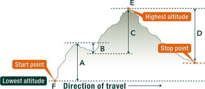
- Cumulative ascent altitude : total of ascent altitudes (A + C)
- Cumulative descent altitude : total of descent altitudes (B + D)
- Highest altitude : altitude measured at the highest point E among all readings during memory measurement
- Lowest altitude : altitude measured at the lowest point F among all readings during memory measurement
- Highest/lowest previous record altitudes
- Sum of cumulative ascent/descent altitudes : computed repeatedly at time of memory measurements between 0 and 99,995 meters
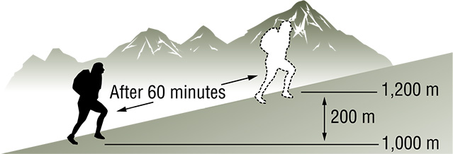
Altitude differential display
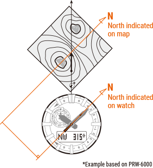
Checking against contour lines on a map enables you to confirm your cumulative ascents/descents. Determining the height of your hourly ascents by resetting the altitude differential display once an hour can be helpful in establishing a reasonable climbing plan, for example.
*These measurement functions are not intended for use as professional instruments. Please use the measured data for reference purposes only.